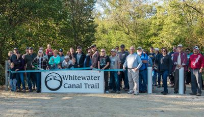
About Us
Exploring the Whitewater Canal Trail
The Momentum is growing as communities realize the value of public trails:
- Attracting visitors and businesses
- Encouraging a healthy lifestyle
- Increasing adjacent property values
- Providing family friendly outdoor experiences
We will soon be doubling our number of trails:
- Yellow Bank, Metamora, and the Billy Jean Jobe Trails are open and maintained
- The Feeder Dam Trail (Metamora to Laurel) is in process. The first two miles is open and is being maintained
Please support our vision of connecting communities throughout the canal corridor.
Trail Overview:
The route of the Whitewater Canal Trail, from the Laurel Feeder Dam in the west to Tecumseh Landing in the east, is unsurpassed in its combination of authentic canal structures, intact canal era buildings and natural scenery. It offers visitors a long list of opportunities that cannot be found elsewhere.
The canal was built in the 1830s, opening the Whitewater River valley for commerce and industry, and establishing new communities. A number of towns, like Metamora, were actually platted right along the canal. The canal provided access to markets for agricultural products and supplied hydraulic power for mills and factories that made flour, lumber, paper and more. Eventually, a railroad was built on the canal’s towpath, further improving transportation services. The flow of water in the canal provided power for the mills for many years.
Visitors to the Metamora section of the Canal Trail will see some of the best examples of authentic canal structures anywhere. These include the historic grist mill in “downtown” Metamora, the one-of-a-kind Covered Bridge Aqueduct and many original buildings from the mid-1800s. Trail parking is available in the lot near the aqueduct.
Behind the grist mill, you can get on the Canal Trail headed west toward the Laurel Feeder Dam. When complete, the Feeder Dam section of the trail will cover four miles, from the US 52 trailhead near Metamora, to the Laurel Feeder Dam. The feeder dam is a small dam on the Whitewater River used to divert water into (“feed”) the canal.
The first two miles of the Feeder Dam section opened in October of 2019. Along this section, you will visit two historic canal locks as you travel along the canal in a quiet woodland setting. The trail ends at Dam Road. Phase 2 is under construction as of July, 2023. You can continue to the Feeder Dam Trailhead, partly on the gravel road, and partly on completed trail.
Going east from Metamora, it’s about 2.5 miles to the “Twin Locks.” You’ll pass through the Whitewater River valley, bordering farm fields and passing through wooded areas. An additional 3.5 miles along the trail will bring you to the Yellow Bank Trailhead, currently the eastern-most access point for the Canal Trail.
There is about one mile of trail to the east of the parking lot, including a wildlife habitat planting and the site of an old ice-harvesting pond. Just a few hundred yards west of the parking lot is a side trail to the Yellow Bank Lock. You can walk into the center of the old lock chamber and then climb the steps to the top of the wall for a view of the entire lock.
Two small parts of the trail in Brookville are open. Parking for the Billy Jean Jobe Trail is on 7th Street, about two blocks west of Main Street. Tecumseh Landing is located at the south end of Brookville. Park near the Family Dollar Store and walk across the railroad track to a gravel beach on Whitewater River.
When completed, the Whitewater Canal Trail will be nearly 14 miles long, following the canal from the Laurel Feeder Dam all the way to the Town of Brookville.
Two sections of the Canal Trail are open and can be accessed at the following points:
Metamora Trailhead
Beginning at the Metamora Trailhead, visitors will see some of the best examples of authentic canal structures anywhere. You can park near the mill in “downtown” Metamora and walk about .4 miles east through historic Metamora - to the Duck Creek Aqueduct. Or, you can park in the lot near the aqueduct. From there, the trail travels 2.6 miles along the Whitewater River valley, bordering farm fields and through wooded areas to the “Twin Locks.”
Yellow Bank Trailhead
From the Yellow Bank Trailhead, there is approximately one mile of trail. To the east, the trail passes a number of interesting features, including a wildlife habitat planting and the site of an old ice-harvesting pond. Just a few hundred yards to the west of the parking lot, you can visit the ruins of the Yellow Bank Lock - due to the generosity of the adjoining property owners, Moster Turf, and financial support from the Canal Society of Indiana.
Tecumseh Landing
At the eastern end of our proposed trail is Tecumseh Landing, located at the south end of the town of Brookville. Visitors can park next to the drive-through Visitor’s Center and then take a short walk, which crosses the railroad track and ends on the bank of the beautiful Whitewater River.
Current plans call for an fourteen-mile trail between the Feeder Dam in Laurel and Butler Run Aqueduct in Brookville.

2026 Board of Directors
- Don Vonder Meulen President
- Tony Montgomery Vice President
- Mary Lierl Treasurer
- Mike Morthorst Secretary
- Alan Abbott
- Curt Andrews
- Tom Cooney
- Jeff Harmeyer
- Shirley Lamb
- Terry Duffy
----
Joey Smith, Ex-officio member